Itinerary Val Pontebbana
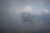
Itinerary, Val Pontebbana - San Marco - Conca di Pricot - Trail C.A.I. 432 - S.Antonio - Val Pontebbana: Excursion time 3.00 hoursDegree of difficulty Touristic - ExcursionResting points Hotels and eating places in PontebbaFrom the residential area of Pontebba take the Val Pontebbana road, for about five kilometres, and after having passed through the residential area of Studena Bassa (630 m.), you reach San Marco (711 m.). From here, take a mule track on the right, which goes upwards along the woody slope to reach a grassy clearing with a building, after about ten minutes. The trail continues to the right, up to the top of the meadows, along a comfortable trail going upwards, crossing a Scots pine wood, the basal part of Mount Pricot (1410 m.). During the climb, crossing a few small watersheds, without any difficulty, you can see the northern slopes of Val Pontebbana and some of the peaks, such as Mount Glazzat (1348 m.) and Crete dal Cronz (1664 m.). Having completed this first climb, the trail continues on a level until reaching the forest road (875 m.) that goes upwards from the bottom of the valley (trail C.A.I. 432). From here, proceed along the road, which has a few bends, until reaching Conca di Pricot , by first crossing a pleasant beech wood characterised by the many erratic masses, to reach the crossroads (1090 m.). Leave the main road and continue to the left along a short section of mule track until the next crossroads (1110 m) where, by turning right and crossing a portion of the ex pasture, full of hazelnuts, you shortly reach the Conca di Pricot. By continuing along the road through the meadows you cross the basin and come to a crossroads (1085 m.). Take the forest road to the right, which descends towards the bottom of the valley to S.Antonio . The road, which has some steep sections but with a good base, descends along the woody slope, crossing Rio Pricot in a few places, which is very characteristic given its visible waterfalls along the route. The descent leads to the asphalt road of Val Pontebbana (680 m.) at about a kilometre further down from the starting point, therefore, you need to go back up (for about twenty minutes) until reaching your car.