The Julian Alps
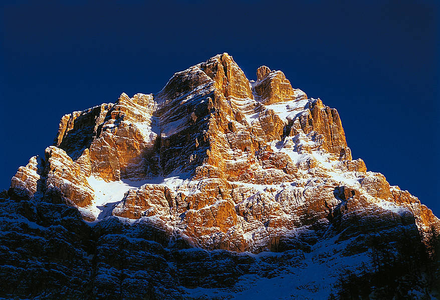
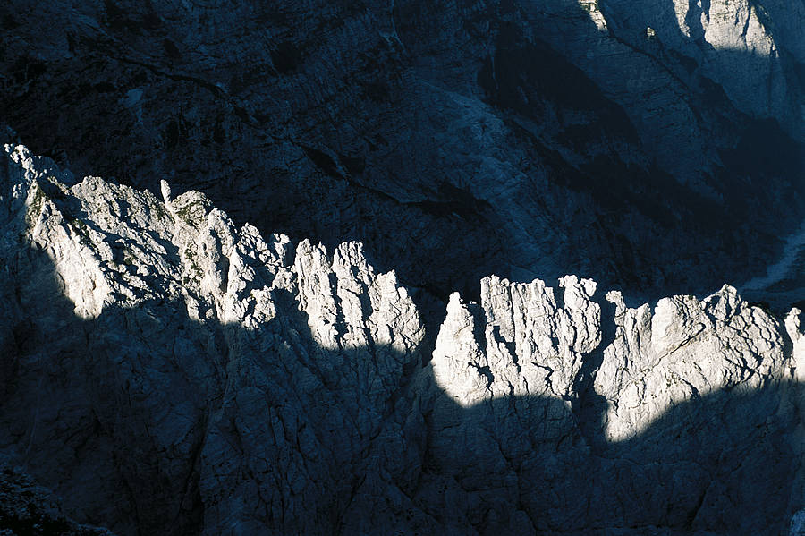
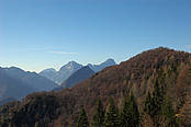
The JULIAN ALPS have a principal western range in Italy, steeper and more inaccessible than the eastern range in Slovenia. In Italy they rise up in the area lying between the Fella river (a tributary of the Tagliamento) and the Upper Isonzo, their lofty dolomitic limestone flanks soaring from the surrounding natural wilderness, where a variety of morphological, fluvial, glacial and carsic processes have shaped the landscape. The imposing mountain walls are topped with grassy ledges and rocky peaks, some solid and others quite friable. The highest pinnacles rise between 2,500 and 2,800 metres. Four peaks, surrounded by wooded slopes, dominate in the western Julian Alps: Mangart (2,688 metres), Jof Fuart (2,666 metres), Jof di Montasio (2,753 metres) and Canin (2,587 metres), the latter being an internationally important site for the study of carsic processes. Large pages of alpine history are written on these mountains.
The valley floors are another feature of the Julian Alps. Although not particularly elevated (600-800 metres above sea level) they nevertheless experience quite severe Winter weather, due to the temperature inversion caused by cold north east winds constantly blowing from Siberia and the Danube region. In some cases there can be a difference in altitude of nearly 2000 metres between the valley floor and adjacent peaks, which was sufficient long ago to discourage alpine sportsmen and deter all but the most ardent and determined climbers.
A cosmopolitan thread runs through the unique atmosphere of these mountains, which provide a home for people of four nationalities, as a passing greeting will often reveal. It is no surprise to hear a German "Gruess Gott" or a Slovenian "Dober dan" rather than the more common Italian "Buon giorno" or a Friulian "Mandi". This linguistic diversity is evident in place names, which can be rather mixed in many areas.
The EASTERN CARNIC CHAIN marks the border with Austria to the north, in the stretch between the Creta d’Aip and Monte Forno. Its southern limit is the Pontebbana river and, upstream of Pontebba, the Fella. We can consider these eastern Carnics as two separate ranges, one extending around the Pramollo Pass, and the other from there to Tarvisio. The Pramollo stretch consists of the desolate mountain ridge extending from Monte Cavallo (2,239 metres), by way of the Madrizze chain, to the Parmollo Pass itself (1,530 metres) and the chain of Auernig (,863 metres), Carnizza (1,950 metres) and Corona (1,832 metres). The Carnic Chain contains other splendid peaks in the area around Pontebba (in the Pontebba and Aup valleys), among them Gleriis (2,058 metres), Chiavals (2,098 metres) and Zuc dal Bor (2,195 metres). The two ranges cover an area that has much to offer to those interested in nature and the environment, with countless trails for pleasant walks along valley floors or high in the peaks mentioned above. The Pramollo area is also rich in fossils, as well as being renowned as the only site in Italy where the Wulfenia Carinthiaca plant species can be found. The stretch of the Carnics running from the Pontebba area to Tarvisio contains peaks that rarely reach 2,000 metres, rising from a smoothly contoured east-west aligned ridge. They present a gently undulating profile, mainly the result of the rock’s low resistance to atmospheric action. This area is also the watershed between the two hydrographic systems mentioned above. The main peak is the striking Monte Osternig (2,050 metres), an imposing grassy peak surmounting a dome of pasture land offering fine views of the highest Carnic and Julian peaks, the Austro-Slovenian Caravanche chain and the Tauri mountains of Austria, towards Salzburg. The mountain morphology in this region has led to the formation of superb valleys named after the rivers flowing through them. Among them we may mention the Filza and Rauna valleys, where numerous baite (alpine huts) and stavoli (shelters for livestock and temporary housing for families) are to be found. There are many marvellous opportunities in these mountains for the tourist who is able to scale the principal and most attractive peaks: Poludnig (1,999 metres), Cima Bella (1,911 metres), Cocco (1,941 metres), Sagran (1,922 metres), Acomizza (1,813 metres), Cima Muli (1,743 metres), Capin di Ponente (1,736 metres) and Goriane (1,693 metres).